File list
This special page shows all uploaded files.
First page |
Previous page |
Next page |
Last page |
| Date | Name | Thumbnail | Size | User | Description | Versions |
|---|---|---|---|---|---|---|
| 15:16, 11 January 2018 | CGC Field Book 2013.pdf (file) |  |
5.62 MB | ML728 | Information on field landings by CGC. | 1 |
| 17:12, 11 January 2018 | Turnpoints.png (file) | 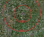 |
2.25 MB | TW466 | Towns and turn points around GRL shown in Google Earth | 1 |
| 23:50, 11 January 2018 | Forces in flight.jpg (file) |  |
124 KB | TW466 | Diagram of forces acting on a glider in flight. | 1 |
| 23:56, 11 January 2018 | Thermal lift.jpg (file) | 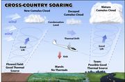 |
34 KB | TW466 | Diagram of glider soaring in thermal lift. | 1 |
| 00:03, 12 January 2018 | Ridge lift.jpg (file) | 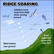 |
15 KB | TW466 | Diagram of glider soaring in ridge lift. | 1 |
| 00:10, 12 January 2018 | Wave lift.jpg (file) | 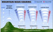 |
32 KB | TW466 | Diagram of a glider soaring in wave lift. | 1 |
| 00:19, 12 January 2018 | Bluebell.png (file) | 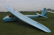 |
535 KB | TW466 | The CUGC Slingsby T21, nicknamed Bluebell. | 1 |
| 12:05, 12 January 2018 | Sky Lions logo.jpg (file) |  |
89 KB | TW466 | Logo of CUGC's competition team | 1 |
| 23:47, 4 February 2019 | Author.jpg (file) |  |
569 KB | TC377 | Tomasz Cebo | 1 |
| 23:49, 4 February 2019 | 500km.jpg (file) | 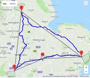 |
124 KB | TC377 | Task | 1 |
| 00:04, 5 February 2019 | CU.jpg (file) | 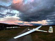 |
1.91 MB | TC377 | G-CUGC | 1 |
| 20:38, 5 February 2019 | TC2.jpg (file) | 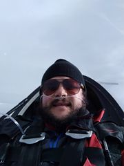 |
492 KB | TC377 | Tomasz Cebo | 1 |
| 20:42, 5 February 2019 | Caringorms.jpg (file) | 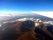 |
2.12 MB | TC377 | Cairngorms | 1 |
| 20:48, 5 February 2019 | Wave.jpg (file) | 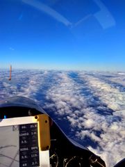 |
2.07 MB | TC377 | wave pattern | 1 |
| 20:53, 5 February 2019 | Sunrise.jpg (file) | 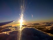 |
2.08 MB | TC377 | Sunrise over wave clouds | 1 |
| 20:58, 5 February 2019 | Morning.jpg (file) | 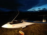 |
1,022 KB | TC377 | Early start | 1 |
| 21:13, 5 February 2019 | Track268km.jpg (file) | 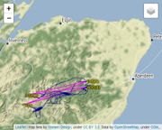 |
74 KB | TC377 | 1 | |
| 21:22, 4 March 2019 | CU Main Pins.jpg (file) | 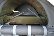 |
359 KB | TW466 | Main pins of CU in place but not yet rotated and latched. | 1 |
| 21:42, 4 March 2019 | CU new skid.jpg (file) | 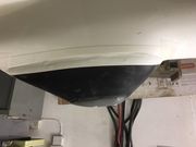 |
30 KB | TW466 | New tail skid on CU. Picture turned 180 degrees as the glider was upside down in the workshop. | 1 |
| 21:45, 4 March 2019 | CU ballast weights.jpg (file) | 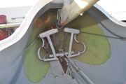 |
276 KB | TW466 | Ballast weights fitted in CU. They are quite hard to reach. | 1 |
| 16:31, 6 March 2019 | Varsity2018Day2.JPG (file) |  |
238 KB | CJB259 | 1 | |
| 16:33, 6 March 2019 | Varsity2018Day3.jpg (file) |  |
495 KB | CJB259 | 1 | |
| 10:14, 7 March 2019 | AGM2018.jpg (file) |  |
1.44 MB | CJB259 | 1 | |
| 10:35, 7 March 2019 | Portmoak2018 1.jpg (file) | 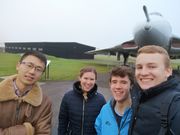 |
4.62 MB | CJB259 | 1 | |
| 10:36, 7 March 2019 | Portmoak2018 2.jpg (file) | 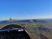 |
2.16 MB | CJB259 | 1 | |
| 10:36, 7 March 2019 | Portmoak2018 4.jpg (file) | 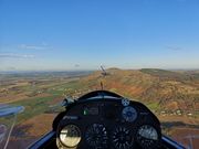 |
2.04 MB | CJB259 | 1 | |
| 13:06, 11 March 2019 | CUGC history glider.jpg (file) | 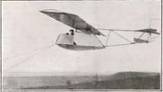 |
25 KB | TW466 | The Cambridge Gliding Club's first machine being taken off Dunstable Downs by the Duke of Grafton. From S&G April 1935 | 1 |
| 13:09, 11 March 2019 | CUGC history war.png (file) |  |
491 KB | TW466 | From old website backup. | 1 |
| 01:09, 13 March 2019 | Training progression.svg (file) | 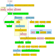 |
31 KB | TW466 | SVG rendering of training progression graph from old website. | 1 |
| 12:32, 13 March 2019 | CU profile.jpg (file) | 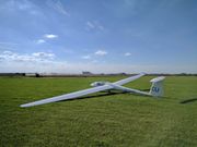 |
348 KB | TW466 | CU at Gransden (from the current website). | 1 |
| 20:16, 14 March 2019 | Venturi tube.png (file) |  |
7 KB | TW463 | Schematic of a venturi tube, used to illustrate a total energy probe. | 1 |
| 20:37, 14 March 2019 | Cylinder total energy tube.PNG (file) | 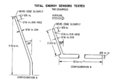 |
68 KB | TW463 | Schematic drawing of two kinds of cylindrical total energy tubes tested by NASA. | 1 |
| 16:45, 18 April 2019 | 2019 Mynd Group.jpg (file) |  |
641 KB | CJB259 | 1 | |
| 16:46, 18 April 2019 | 2019 Mynd Hangar.jpg (file) | 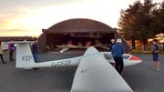 |
481 KB | CJB259 | 1 | |
| 07:11, 17 May 2019 | Viewranger NewTrack Step3.PNG (file) | 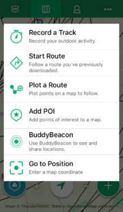 |
212 KB | GGLG2 | Step 3 | 1 |
| 07:20, 17 May 2019 | Viewranger NewTrack Step4.PNG (file) | 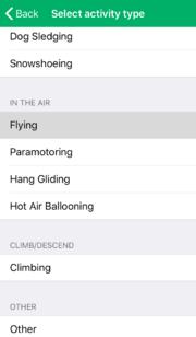 |
57 KB | GGLG2 | Step 4 – Scroll down the list of activities and select “flying”. | 1 |
| 07:22, 17 May 2019 | Viewranger NewTrack Step5.PNG (file) | 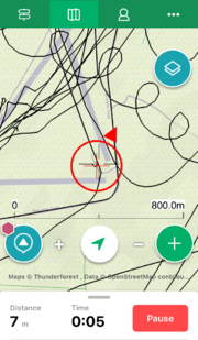 |
467 KB | GGLG2 | Step 5 – The track will start recording. | 1 |
| 07:22, 17 May 2019 | Viewranger NewTrack Step6.PNG (file) | 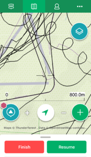 |
458 KB | GGLG2 | Step 6 – Before you climb in to the glider, select “resume” to start recording. | 1 |
| 07:23, 17 May 2019 | Viewranger Started Step3.PNG (file) | 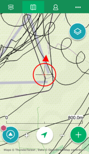 |
528 KB | GGLG2 | Step 3 – Select map view by tapping the second tab from left on the top menu bar. | 1 |
| 07:29, 17 May 2019 | Viewranger Manage Step2.PNG (file) | 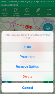 |
344 KB | GGLG2 | Step 2 – To hide the track, select “Edit” and then “Hide”. | 1 |
| 07:30, 17 May 2019 | Viewranger Manage Step3.PNG (file) | 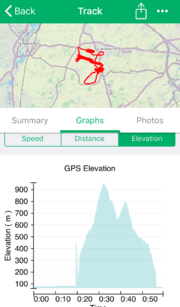 |
325 KB | GGLG2 | Step 3 – To view more information, select “Details”. You can see your speed and altitude information from the “graphs” section. | 1 |
| 07:32, 17 May 2019 | Viewranger Export Step2.PNG (file) | 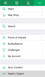 |
76 KB | GGLG2 | Step 2 – Scroll down and select “Import/Export”. | 1 |
| 07:33, 17 May 2019 | Viewranger Export Step3.PNG (file) | 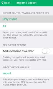 |
100 KB | GGLG2 | Step 3 – Select “Only Visible” to export only the tracks visible on the map as a .gpx file. | 1 |
| 07:33, 17 May 2019 | Viewranger Export Step6.PNG (file) | 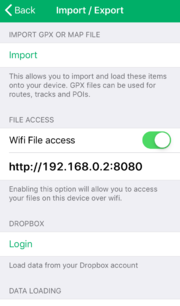 |
89 KB | GGLG2 | Step 6 – To access the file, scroll further down and enable “Wifi File Access”. Ensure your computer and phone are on the same WiFi network. | 1 |
| 07:34, 17 May 2019 | GE Step4.png (file) | 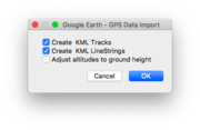 |
54 KB | GGLG2 | Step 4 – Check “Create KML Tracks” and “Create KML Linestrings”. Make sure “Adjust altitudes to ground height” is unselected, since you wish to view your altitude. | 1 |
| 07:35, 17 May 2019 | GE Step6.png (file) |  |
1.54 MB | GGLG2 | Step 6 – Try panning the camera obliquely to the ground. | 1 |
| 07:36, 17 May 2019 | GE Step8.png (file) |  |
90 KB | GGLG2 | Step 8 – If you cannot see your track, or if you want to view your track over time, try adjusting the time sliders in the top-left corner. | 1 |
| 07:38, 17 May 2019 | GE Step9.png (file) |  |
1.43 MB | GGLG2 | Step 9 – Occasionally, the track will be jagged/spiky in places, especially in the vertical axis. | 1 |
| 07:43, 17 May 2019 | GMap Step4.png (file) | 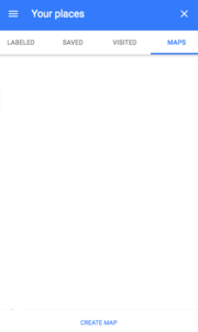 |
22 KB | GGLG2 | Step 4 – Click on “Create Map” at the bottom. | 1 |
| 07:44, 17 May 2019 | GMap Step5.png (file) | 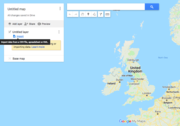 |
178 KB | GGLG2 | Step 5 – Select “Import” under the new Untitled layer. | 1 |
First page |
Previous page |
Next page |
Last page |